06/13/18 Release
Ensure you are seeing the latest changes
Due to browser caching, you may need to hard refresh your browser to see the latest changes. This can be done by using the following short cut keys:
Windows: Type Ctrl-F5
Mac: Type Cmd-Shift-R
New Features in this Release
Separate Results Window
Users now have the ability to view their results table in a separate window that can be moved independently from the main application map page. This is especially useful for those with two monitors.
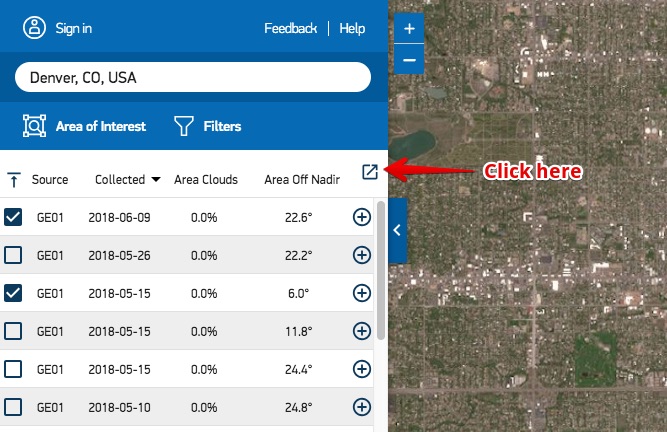
Figure 1: Open separate results window
Area of Interest Upload Enhancements
The file upload functionality was improved in this release. Uploads now complete faster, and support was added for the uploading of a single .shp without needing to zip supporting Shapefile files together. Zipped Shapefile, KML, and KMZ uploads are still supported.
New Area of Interest Download File Formats
Users now have the ability to download their area of interest in two additional formats: GeoJSON and Well Known Text (WKT).
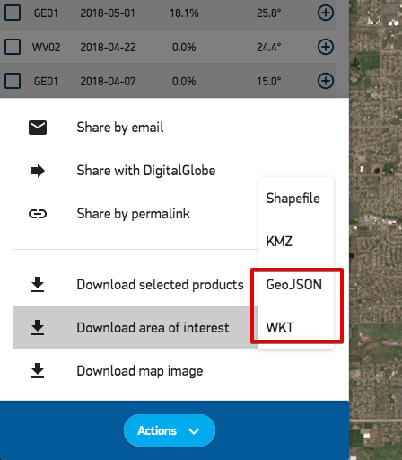
Figure 2: New file formats
Downloading Fulfilled and Unfulfilled Area of Interest Geometries
When users download an area of interest that is not completely covered by selected images they will now also receive a fulfilled and unfulfilled area of interest geometry. These will be named accordingly in the output.
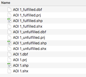
Figure 3: Example Shapefile output
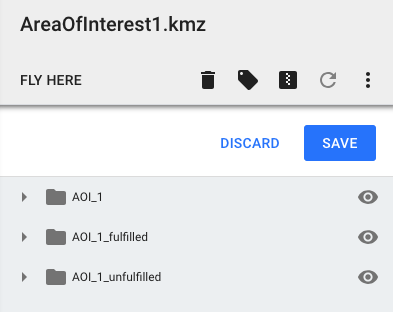
Figure 4: Example KML/KMZ output
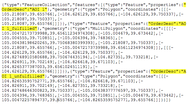
Figure 5: Example GeoJSON output
Defining Multiple Area of Interest Geometries
The following is now supported for defining multiple area of interests in a single session:
- In a single file upload, users can now upload more than one Shapefile zipped together.
- If a multipolygon geometry is included in an upload or direct coordinate entry, each polygon within the multipolygon geometry will be treated as a separate area of interest.
- There is no longer a set upper limit on the number of areas of interest that can be defined and searched on. The applications limit will depend on the complexity of the geometries and the browser you are using.
- To map an area of interest name into the application the upload file must have an attribute named "OrderDesc" that contains area of interest name values.
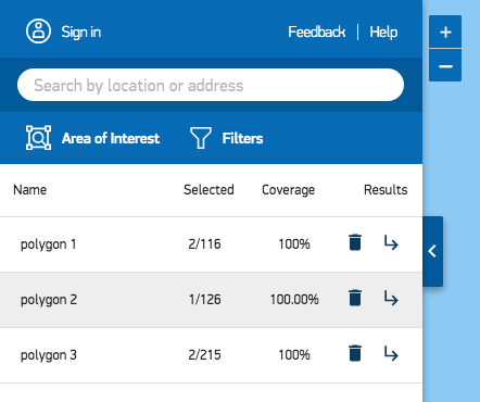
Figure 6: Multiple Area of Interests Defined and Named
Coordinate Entry Enhancements
- Any defined center point geometry is now also translated into the three direct entry options.
- The user entered center point or direct entry geometry is saved after a search so that it can be easily edited.
- When entering a GeoJSON geometry the FeatureCollection type is now supported for entering many feature geometries for multiple areas of interest.
- A multipolygon geometry type is now allowed for WKT and GeoJSON direct entry geometries.
Area of Interest Coverage Km2
The area of interest coverage Km2 is now displayed as opposed to the coverage percent that was previously displayed.
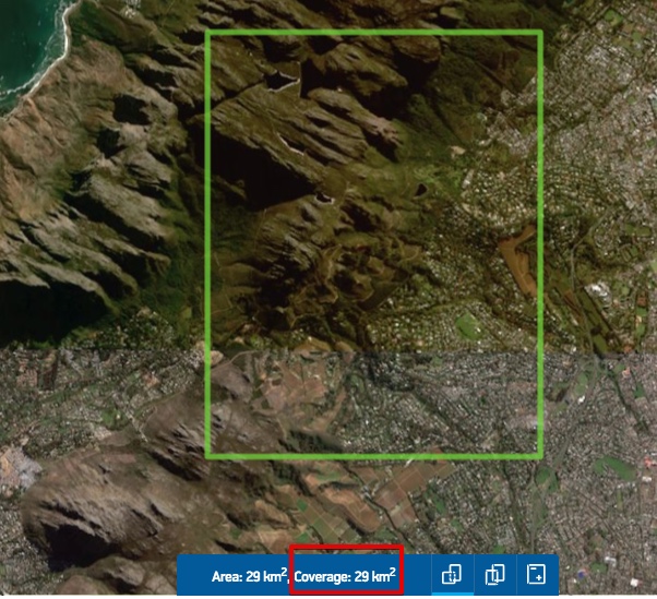
Figure 7: Coverage Km2
Area of Interest Km2 Size While Editing
Users can now see the approximate size of their area of interest as they edit each vertex.
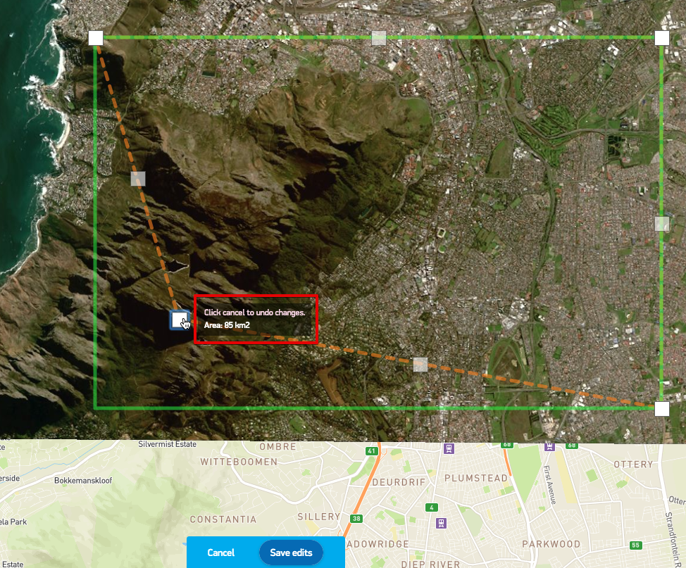
Figure 8: Approximate Area Displayed During Edits
Bottom Bar Functionality
The following functionality has now been moved to the bottom snack bar on the map:
- Clip selections to area of interest
- Show footprints of selected
- Set image transparency
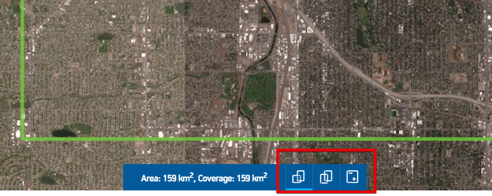
Figure 9: Snack Bar Tools
Keep Current Image Selections on New Search
The "Locked Selected" option has been removed in favor of a new automatic selection option named: "Keep current selections". Selecting this option will keep current image selections regardless of filter changes and area of interest edits. The area of interest must still intersect the selections for them to be returned.
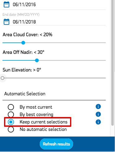
Figure 10: Keep Current Selection Option
Move Selection to Top
Move Selected to top icon has been moved to the results column header.
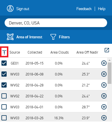
Figure 11. Move Selected to Top
Updated almost 6 years ago
